
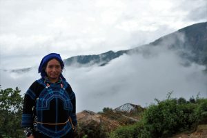
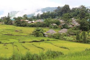
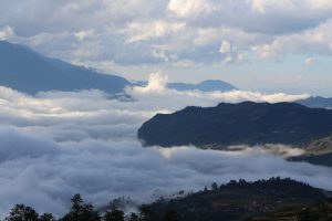
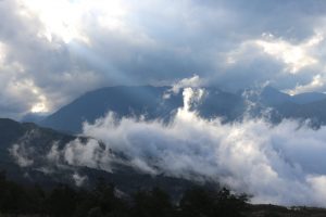
Y Ty is located at a height of over 2,000m, back resting on the mountain Nhiu Co San which peak to 2.660m, almost all over the cloud cover. The sun is probably less than a day to shine for 12 hours. The road to Y Ty is a zigzag trail of narrowed paths and then falls on the leaves of the forest, the houses looming in the clouds.
Sightseeing in Y Ty
The tourist spots in the post are arranged in the direction from Lao Cai City to Bat Xat and from here along the Red River to Lung Po and go straight to Y Ty, or From Sapa to Ban Khoang – Ta Giang Phing village reach to Muong Hum then go direct to Y Ty.rest here you can explore Lao Than Mountain by trekking, Nhiu Co San , Den Sang, visit the local market, the rice terraced or seating to enjoy the cloud around . etc..
How Y Ty is the unique destination?
It is true that when you come to Y Ty. Visitors feel like you are entering another world, separated from the world. The road to Y Ty now has been upgraded, no longer the scene of muddy roads, muddy as a few years ago. As well as beautiful places in the uplands. To visit Y Ty you should note some information before traveling.
Y Ty is a highland border commune of Bat Xat district in 135 extremely difficult communes with 8654 ha of natural land and 11.94 km of borderline. The commune has a total of nearly 800 households living in 16 villages with 4 ethnic groups (Mong, Ha Nhi, Dao, Kinh), in which the rate of poor households is high, accounting for 77.5%.
Located at an altitude of over 2,000m above sea level. Y Ty has cool weather year-round. Especially compared to other communes in Bat Xat district in the winter. Winter temperatures sometimes drop below 0°C. There is one of the trekking spots of interest to young people.
Y Ty is also the only place where much ethnic minority Ha Ni live. With unique cultural identity and primitive forests. Such as the “forest” on a rocky mountain. Therefore, this is one of the attractions of tourists and people “Solo travellers” especially young people to explore and conquer the difficult road, like an adventure for life.
It has a sub-temperate continental temperate climate, which is typical for medicinal plants and temperate fruit trees. Over the past years, authorities and people in Y Ty have expanded the production area of medicinal plants, to promote local strengths. Compared with traditional crops such as corn and rice, medicinal plants are more economical.
When is the best time to go to Y Ty?
Depending on your individual time, you can arrange a medical appointment at any time that suits you, but for a full trip you can refer to some suggested information. Below is as follows:
- The hunting season is from September to April next year. You notice the weather if it is cold (especially at night) but dry autumn style can go hunting clouds.
- In late March and early April, the azaleas will bloom, making the Y Ty forest very colorful.
- Next to May-June is the season of the fall, the fields in Y Ty as the picture always.
- If you like to participate in the largest festival of the Ha Nhi people in the year, please come to the dry festival on the first day of the sixth lunar month. Depending on the year, it may fall into the range of 7-8.
- The ripe rice crop of Yutin is around the end of August until the end of September, depending on the year. In recent years, Y Ty has focused on ripe rice on the occasion of the autumn festival (next week of September 2).
- Last year in winter, Y Ty is likely one of the possible snowfall spots with Sa Pa and Mau Son.
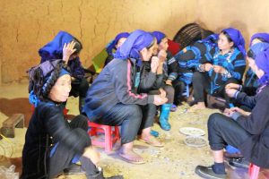
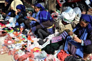
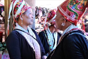
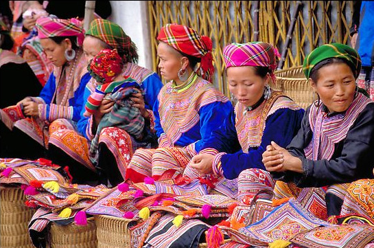
Being a minority ethnic people market, Bac Ha market is located in 80 km from Sapa, Bac Ha is famous for its Sunday market which is a trading center and meeting place for couples, friends, and relatives.
Every Sunday, Bac Ha hosts the biggest fair near the mountainous highlands and the Chinese border. It is the largest and most colorful market in the area and attracts throngs of villagers from the surrounding hill tribes. Some walk several hours for the weekly opportunity to trade and barter food, animals, clothes, and household goods. 80km from Sapa, Bac Ha Market is not only the place for buying and selling but also a place for cultural and sentiment exchanging. On the market days, right from the early morning, all paths and mountain roads are full of people and horses pouring to the market. People usually sit in groups around a soup pan (“thang co”) eating and chatting.
Many different ethnic groups such as Flower H’mong, Phu La, Black Dao, Tay and Nung minorities gather to buy and sell local products that cannot be found elsewhere. The market was very crowded, local products for sale or barter are carried on horseback. Besides the usual items like pigs, cows, chickens, and ducks, Bac Ha Market sold dogs. As dogs were available as cuts of meat, they were also available live, right next to the live pigs, chickens, and other livestock. There was a brisk trade at the market for everything from hand-embroidered skirts to all manner of 4-legged animals. The “fresh” meat section is not for the faint of heart and might steer more than a few visitors in the direction of strict vegetarianism.
Though tourists were not in short supply, they were not the focus. Most locals paid little attention to them, rather choosing to focus on their business and the short Sunday-sized window of opportunity. Rounding the corner and pungent fumes of alcohol accosted your senses of smell, from corn whiskey, a Bac Ha specialty. The potent moonshine is decanted by vendors from large white plastic jugs to used bottled water containers. If you doubt the ability of a vendor’s hooch to peel paint or light your senses on fire, you can try a shot for free.
At the fair, adventurous gastronomes can try “thang co” blood porridge, a popular dish of the H’Mong and other local people. The Flower H’mong minority is the most common here, and their colorful dresses make is a beautiful sight.
Let’s once visit Bac Ha Market and you will be able to experience a wide range of different colorful ethnic minorities and more interesting things of life in the mountains…
Location: Fansipan Mountain is located 9km south-west of Sapa Townlet in the Hoang Lien Mountain Range.
Characteristics: Fansipan is branded “the Roof of Indochina” at the height of 3, 143m; Fansipan Mountain is to be approved as one of the very few eco-tourist spots of Vietnam, with about 2, 024 floral varieties and 327 faunal species.
The topography of Fansipan is varied. Muong Hoa Valley, at the lowest altitude (950-1, 000m), is created by a narrow strip of land at the base on the east side of the mountain.

Geologists say the Hoang Lien Mountain Range, with Fansipan as its highest peak, did not emerge in the mountainous North West of Vietnam until the neozoic period (circ. 100 million years ago). Fansipan, a rough pronunciation of the local name “Hua Xi Pan” means “the tottery giant rock”. The French tour to Vietnam and in 1905 planted a landmark telling Fansipan’s height of 3, 143m and branded it “the Roof of Indochina”. Very few people climbed to the top of Fansipan at the time. Then came the long years of war and Fansipan was left deserted for hunting and savaging. The trail blazed by the French was quickly overgrown by the underbrush.
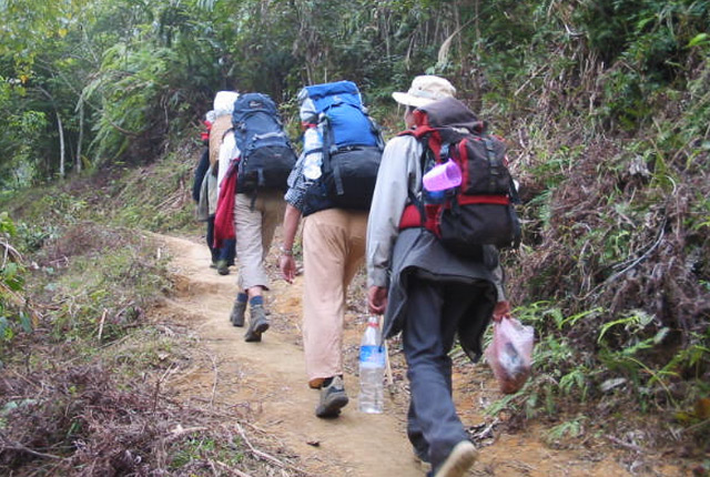
Fansipan Trekking
It takes six or seven days to reach the 3, 143m summit, the highest peak of the Indochina Peninsula.
In 1991, Nguyen Thien Hung, an army man returned to the district town and decided to conquer Fansipan. Only on the 13th attempt did Hung, with a H’Mong boy as his guide, conquer the high peak by following the foot steps of the mountain goats. Scaling the height was meant to satisfy his eager will and aspiration to conquer the mountain without expecting that his name would be put down in the travel guidebook. After that the Sapa Tourism Agency started a new package tour there. It seemed the Fansipan Tour was meant only for those who wished to test their muscular power.
The summit of Fansipan is accessible all year round, but the best time to make the ascent is from mid-October to mid-November, and again in March.
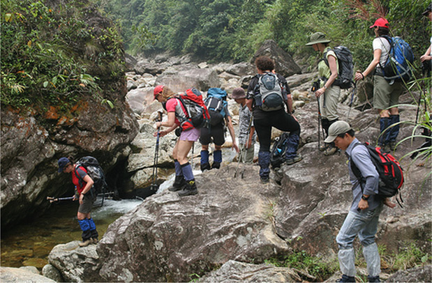
Fansipan Trekking
Foreigners like best to book Fansipan tours between October and December, as this period is more often than not free from the heavy rains that obstruct the jaunt. But the Vietnamese prefer their tours to the peak of the mountain from February to April, as it is not so cold then. However, the best time for the trek to the mountain is from the end of February to the start of March, when the flowers all flourish and the climbers may behold the.
Though Sapa has long been familiar with tourists, Ta Phin Village is still a new name to almost everybody. Located about 14km in the west of Sapa, Ta Phin is a village of Red Dao’s people possessing a rich culture that has not been damaged by modern life.
Ta Phin is the nearest village of Red Dao’s ethnic group within the area of Sapa district. From Sapa, it will take about 30 minutes to reach here by motorbike. The mountainous road can make it difficult for cars to move, so the best solution is to hire a “xe om”, or motorbike taxi, and the experienced driver will take you to the right place at a very reasonable price with many useful advice and tips.
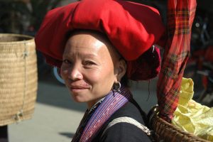
Ta Phin Village Sapa Vietnam
Coming to Ta Phin, you will immediately catch sight of groups of Red Dao’s women gathering together, keeping inside their hands colorful reels of thread and cloths. They sew continuously, even when offering the goods to the customers. Amazingly, most of them can speak quite well, some use Vietnamese less than English. Since 1998, Ta Phin has officially become the “brocade village”, where tourists can find the distinctively hand-made brocades made by ethnic people. All of the products are eye-catching with numerous bright colors and patterns, ranging from bags, scarves, purses, to skirt, and even backpack and coat. Ta Phin is also the main supplier of brocades for shops in Hanoi and Ho Chi Minh City, and the products are exported to foreign countries as well.
Through times, Ta Phin Village, however, still can retain its special traditions. If you are lucky enough, you can have a chance to participate in a Red Dao’s wedding, seeing how carefully they prepare and many complicated customs for this occasion. There are also several local festivals such as “dancing festival”, “greeting for the new house”, and “oath-taking ceremony” that will help you understand more about the simple but happy and amiable life of ethnic people.
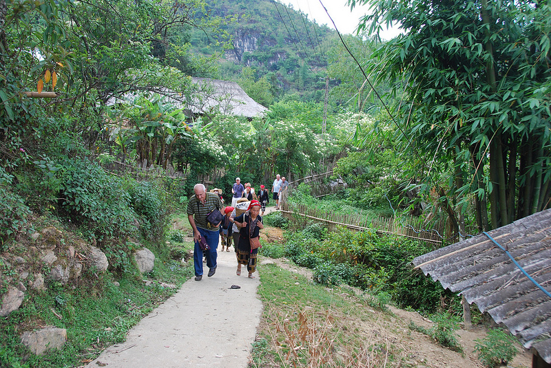
As of May 11, 2013, cable car to the top of Fansipan was inaugurated on the morning of February 2. This is a modern three-wire cable, the first in Asia presence. The total investment in the first phase of the project is 4,400 billion VND. The distance from the Muong Hoa peaked go through 6 main pillars, each pillar being 1 km.
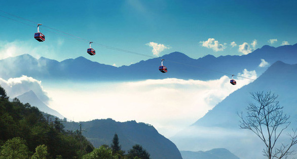
The Guinness Book of World Records has awarded two Guinness certifications for the Fansipan Sapa, including a three-wire cable car station and the difference between the world’s largest arrivals (1,410 m) cable cars and the world’s longest three-wire (6292.5 m).
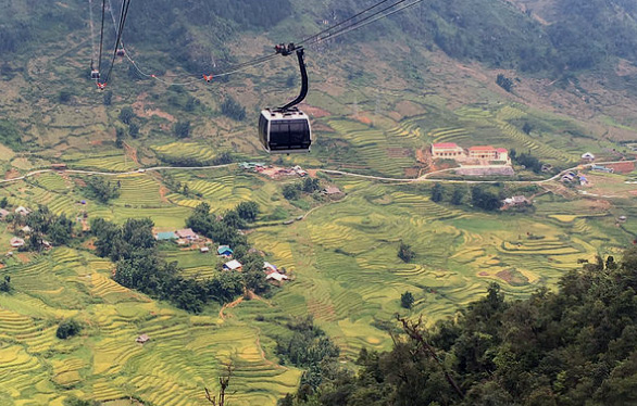
Each cable car cabin can accommodate up to 35 guests, with a transport capacity of up to 2,000 people per hour. The time to go to the gas station to just 15 minutes.
The northwest mountainous area is famous for its extraordinary and poetic beauty, which changes with every season of the year. For Sa Pa lovers, Muong Hoa Valley is one of the most famous destinations for breathtaking scenery and is the largest farmland for rice growing in SaPa. It is far from Sapa town about 14 kilometers. Muong Hoa Valley is especially delightful. It is beautiful during both the new rice and harvest seasons thanks to the unique terraced fields.

Muong Hoa Valley is stunning in the ripe paddy season
It takes about 5 hours for visitors to walk downhill to the valley, have enjoyed taking a mid-mountain hike to treat themselves to this spectacular view. However, the best way to enjoy this unique specialty of the town in fog is to view it from above, choosing a mid-mountain spot to appreciate this magical green trail. Visiting Muong Hoa Valley, you will enjoy an easy walk downhill and along Muong Hoa River, through terraced fields passing some hamlets of the H’Mong people as Y Linh Ho, Lao Chai, Ta Van…, watching locals at work. The night you spend in Ta Van village. The unique village in Sapa area where Giay minority live will be an excellent and remarkable experience.
It takes about 5 hours for visitors to walk downhill to the valley, tracing the Muong Hoa River, through its terraced fields and passing hamlets of minority groups in Muong Hoa Valley. The valley, being part of Mt. Fansipan’s varied topography, is at the lowest altitude of about 1000 meters and is the home for H’mong, Zao, Zay minority groups, who have been working on the slopping land and living their own ways of life for hundreds of years.
The largest farmland of the Sapa district
From the highest elevation of the mountain range covered by endless forest, rainwater follows dozens of streams downhill to the floor forming the Muong Hoa, which follows across the small town and rice fields of the ethnic minority people of H’Mong, Dao and many others. They has been working on the slopping land and living their own ways for hundreds of years.
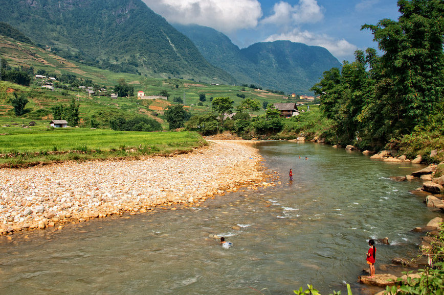
Muong Hoa River
Muong Hoa River peacefully flows through the valley, weaving itself along feet of mountains, nourishing the earth and the people. On rice season, the rice farmland valley serves up different shades of green and yellow, in ranges of ranges. Patches of colors lining side by side each other create amazing sensual patterns and a sublime and majestic landscape.
Every year on Dragon’s first lunar month, Ta Van commune, Sapa district, open the festival to welcome a new year for a bumper harvest. The Giay, H’mong, Dao ethnic… and a large number of tourists come here, which makes Muong Hoa valley becomes more vibrant and colorful. Previously, Ta Van Giay was called the Roong Pooc festival. Although it is the traditional festival of Ta Van ethnic, for many years it has spread to become the festival of the whole valley of Muong Hoa. Tourists from Sapa attend and the festival ambiance spreads throughout the valley of Muong Hoa.